

Digital analysis of stationary traffic (DARuV)
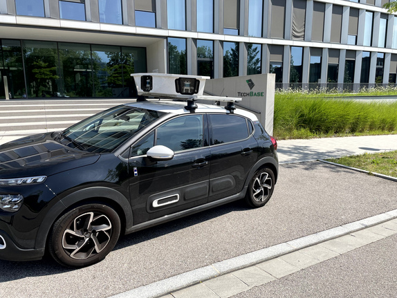
Avoid congested city centers and manage urban infrastructure more easily. With the right data, ecological, monetary and social issues can be addressed. The aim of the project is to carry out a digital traffic space analysis of stationary traffic for the area of the Galgenberg real-world laboratory without interfering with the existing infrastructure, but using data protection-compliant, mobile multi-sensors (CITYSCANNER).
The use of mobile sensor technology is to be tested on 4-5 days of driving, which replaces many stationary sensors and therefore does not require huge upfront investments in hardware. At the same time, the data should be made available to mobility stakeholders in order to gain insights (e.g. traffic planning, derivation of new business ideas). Ideally, the data should then be integrated into the planned Mobility Data Hub.
>>> To the image film about the project DARuV. <<<
Statements on traffic situations and the resulting possible measures are therefore no longer based on subjective perceptions and impressions but are underpinned by real data.
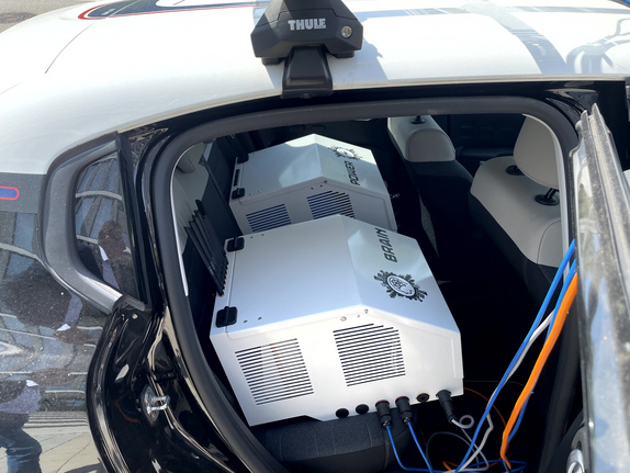
The multi-sensor CITYSCANNER® system consists of several optical components (color and monochrome cameras), two LIDAR units (laser-based systems for distance determination) and a high-precision GPS system for determining the position of the vehicle as it drives through an area. With the help of RTK corrections (via Leica Geosystems), the positioning accuracy of the system is further increased. Parallel to and in advance of the surveys using CITYSCANNER®, the existing digital data, e.g. from digital twin surveys or existing aerial images, is evaluated. The information from several data sources is then combined with the data from the on-site surveys.
The data collected at Galgenberg is stored, analyzed and visualized:
DCX Innovations GmbH is responsible for the technical implementation and the Cluster Mobility & Logistics for project coordination, stakeholder management and communication of the project
Project duration: 01.07.2024 - 31.12.2026 (test days are scheduled for July and November 2024)
The DARuV (Digital Analysis of Stationary Traffic) project is an application project in the R_Lab Mobility, a real-world laboratory for urban mobility.
A press conference was held on 5 November 2024 to mark the launch of the DARuV project. The application project was presented in the TVA video of the press conference.
The application project contributes to strategic, urban development policy components of the Regensburg Plan 2040 in the areas of mobility and the digital and smart city:
Uwe Pfeil
Cluster manager
Tel. +49 941 604889 55
uwe.pfeiltechbase.de